

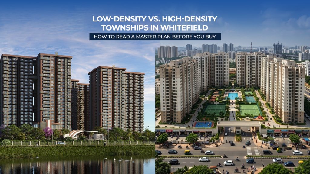
Quick answer: “Low-density” is not a regulated or standardized term — it’s used inconsistently across marketing materials. The actual, verifiable numbers to check are: Floor Area Ratio (FAR), open space percentage, total units divided by total acreage, and number of towers relative to land parcel size. These four figures, cross-checked against the sanctioned master plan, tell you far more than the word “low-density” ever will.
Nearly every township and high-rise project launching in Whitefield in 2026 describes itself as “low-density” or “spacious.” Since there’s no fixed legal definition of either term, this section teaches you to read the actual master plan numbers instead — the same way a developer’s own planning team would evaluate a competing project.
Why “Low-Density” Alone Tells You Nothing
A 70-acre township with 5,000 units and a 5-acre plot with 300 units can both plausibly market themselves as low-density relative to some comparison point. Without the underlying numbers, the word is meaningless. The four metrics below fix that.
Floor Area Ratio (FAR) / Floor Space Index (FSI)
FAR is the ratio of total built-up floor area allowed to the total plot area, set by local municipal regulations and confirmed in the sanctioned building plan. A higher FAR generally permits more built area — and therefore more units — on the same land parcel. Ask for the. FAR the project has utilized, and compare it against the maximum FAR permissible for that zone; a project using significantly less than its maximum permitted FAR is making genuine, verifiable low-density choice, not just a marketing one.
Open Space Percentage
This is the percentage of the total land parcel left as genuinely open, unbuilt space — not counting building footprints, podium structures, or paved driveways. Ask for this figure directly from the sanctioned plan, and separately ask what counts as “open space” in the calculation, since some projects count paved courtyards or podium decks as open space when buyers might reasonably expect landscaped ground-level green area.
Units Per Acre
Divide the total sanctioned unit count by the total land parcel size in acres. This single number, more than any other, predicts your daily experience: lift wait times, parking availability, common area crowding, and how quickly amenities like the swimming pool or
gym feel genuinely usable versus overcrowded.
| Density Range (Units/Acre) | Typical Experience |
| Under 60 | Low density — shorter lift waits, less common-area crowding |
| 60-120 | Moderate density — typical for mid-size high-rise developments |
| 120+ | Higher density — common in large-scale townships, requires more amenity capacity per resident to compensate |
(These bands are illustrative for high-rise apartment developments and vary by project type and configuration mix.)
Towers vs Land Parcel Size
A project with fewer, taller towers on a given land parcel generally leaves more ground-level open space than the same total unit count spread across many shorter, wider towers covering more of the footprint. Ask how many towers sit on the total acreage, and what percentage of the ground floor footprint the towers themselves occupy.
How to Actually Verify These Numbers
- Request the sanctioned building plan – not just the marketing master plan render — the sanctioned plan is filed with local planning authorities and RERA, and is a legal document, not a sales illustration.
- Cross-check the RERA filing – on rera.karnataka.gov.in, which typically discloses total units and land area.
- Calculate the ratios yourself – units/acre, and confirm the open space percentage against the total parcel size, rather than accepting a pre-stated percentage without the underlying figures.
- Ask what’s excluded from “open space” – clarify whether paved areas, podium decks, or setback zones are included in the quoted percentage.
Putting It Together: A Worked Example
If a project markets “78% open space” on an 8.25-acre parcel with 7 towers, that means roughly 6.4 acres remain genuinely unbuilt — landscaped, walkable, green space — while the towers themselves occupy the remaining footprint. Divide the total sanctioned units by 8.25 acres to get the units-per-acre figure, and you have a verifiable, comparable density metric rather than a marketing adjective.
Tru Aquapolis is built on 8.25 acres with 7 towers and 78% open space — figures that are checkable against the sanctioned plan and RERA filing (PRM/KA/RERA/1251/446/PR/040625/007808), rather than a standalone claim.
Frequently Asked Questions
What does Floor Area Ratio (FAR) actually control?
A: FAR sets the ratio of total permitted built-up floor area to plot area under local municipal regulation. It’s a key factor determining how much a developer can build — and therefore how many units — on a given land parcel.
Is a higher open space percentage always better?
A: Generally, more genuine open space improves ventilation, green cover, and a less crowded feel, but always confirm what’s included in the calculation — some projects count paved courtyards or podium decks as “open space.”
What’s a good units-per-acre figure to look for?
A: This varies by project type and land value, but as a general guide, under roughly 60 units per acre is considered low density
for high-rise apartment developments, while above 120 leans toward higher density, requiring more amenity capacity per resident to compensate.
Where can I get the actual sanctioned plan rather than a marketing master plan render?
A: Request it directly from the developer, and cross-check unit count and land area disclosures on the project’s RERA filing at rera.karnataka.gov.in.
Related reading:
Master Plan · Project Overview · Understanding RERA in Karnataka